Photographic, Video, Timelapse and Airborne Equipment Payloads
Terra Measurement brings you our expertise in image based survey, inspection, filming and airborne sensing.
With our team of professionally qualified pilots, and the latest advancements in UAV (Drone), Camera, software, internet and computer technology - we can bring an amazing array of both essential or added value products to you projects.
With our drive for innovation and genuine improvements, we can provide you with a world of immersive deliverables, cinematic films or timelapse site progress reports. With UAVs, mast installations, Tripod or camera rigs, we provide a selection of survey and media that integrates with our Spatial Data processes and deliverables.
UAV Inspection of Buildings, Structures, Confined Spaces and Dangerous Areas
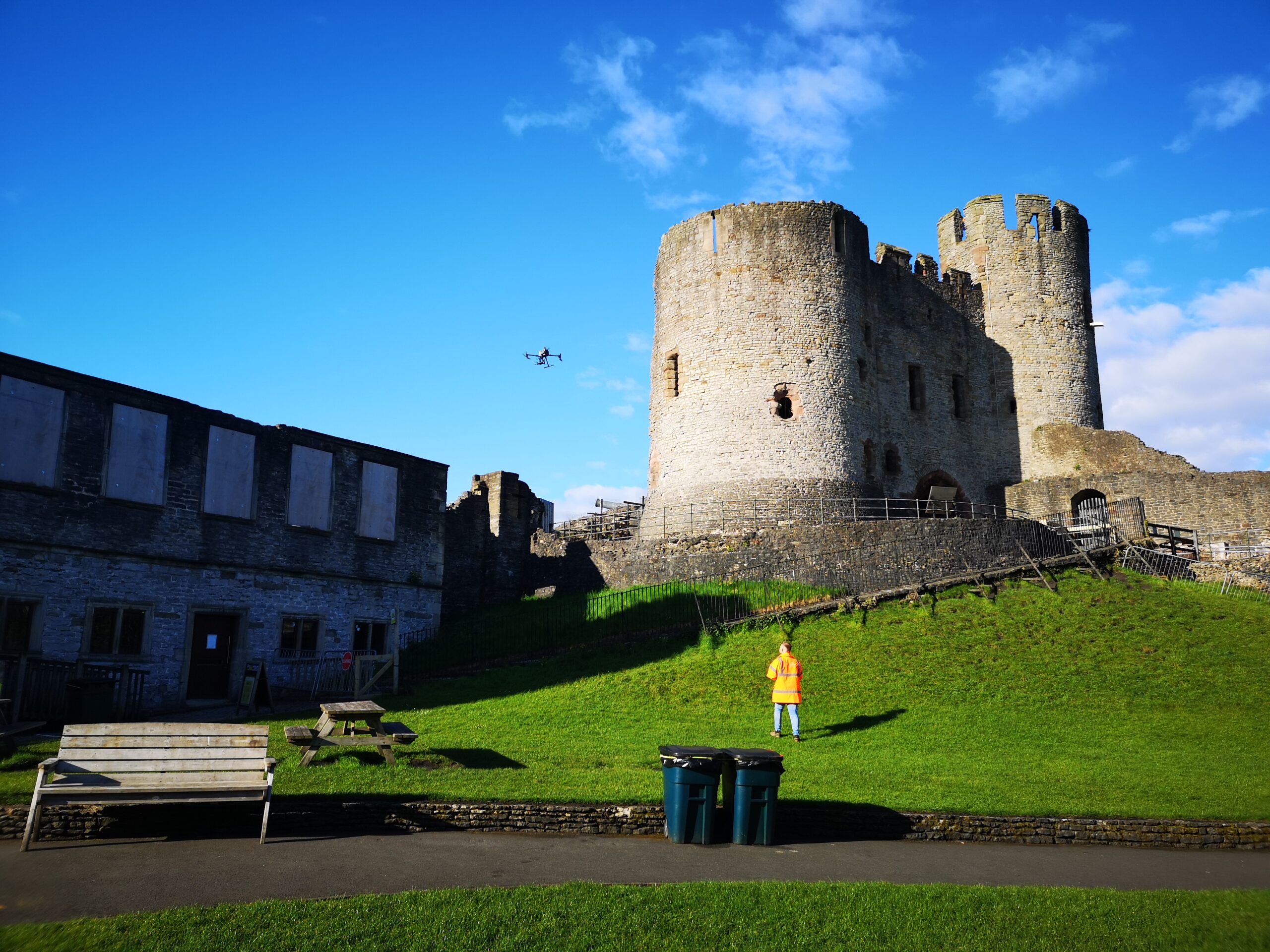
Terra Measurement’s drone asset inspection has already transformed the workflows for many of our clients, reducing costs, time on site and increasing job safety.
A drone inspection is the process of using an unmanned aircraft to assess an asset. In this case, drones literally become the eyes of the inspector.
What are the benefits of drone inspections?
- Drones have the advantage of reaching places that are difficult, expensive, dangerous, live or even impossible to access by manned inspection teams, and they can be used for indoor, underground, onshore or offshore purposes.
- Drones collect incredibly high-quality data, which can be archived to create a detailed record of an asset’s lifecycle.
- Drones can conduct automated, repeatable missions, ensuring the data is consistent each time – especially vital for regular and comparative checks. This data is easily shareable using standard software and analytical tools, such as Pix4D or DJI Terra.

Large Scale Topographical Surveys, Terrain Models and Orthomosaic Overhead Images
Large areas can be captured by UAV Photogrammetry or Lidar in an efficient timeframe for minerals exploration or site feasibility studies.
We use best practice methods and consult our clients to ensure they are getting the data and accuracies they need. We often suppliment a UAV Survey with traditional Topographical Survey methods to ensure a dataset is accurate and complete.
When areas are densly vegetated, we can deploy UAV Lidar to penetrate through leaves and vegetation to locate the best possible terrain levels efficiently, With prior planning, UAV surveys can be commissioned and flown over key areas within a larger project over a relatively small timescale.
These terrain models are a cost efficient method of investigating potential routes for pipelines, new road routes, new railway routes, wind farms and land use studies.


Photography and Cinematic Filming
Whether as part of a UAV inspection or survey, or as a specific commission - we can bring your site or project to life to be shared to customers, stakeholders or website visitors.
Our expert and professional team use our fleet of UAVs (spanning from huge to tiny) to create cinematic video, aerial images, hyperlapse/timelapse or 'supercharged' fast fly through experiences.
Contact us for more details.